
As I was wondering what the hell to write about on Day 12 of this mammoth 100 day task, it dawned on me that I hadn't really discussed any of the FOSS software that I use. Considering I'm a member of Fosstodon I felt a little guilty. So today, you get a quick overview of GPXSee.
As many of you following along with #100DaysToOffload will know, I have a small obsession with triathlon and with health and fitness in general. An unfortunate side-effect of this 'hobby' is proprietary hardware and software. While there are some fantastic apps to track your sports and activities, such as OpenTracks. But you can't always have your phone on you. In fact, most of the time it is strictly against the rules, and not just in triathlon. Straight back in the the Polar/Garmin/Whatever ecosystem you go.
The issue with this is that some software just isn't available for Linux (Polar FlowSync - seriously guys it's bloody a sync tool, sort it...). I wanted to dig in to a GPX file after one of my races after spotting some oddities in the numbers on the web tool. As you may have guessed by the title of the post, I managed to find GPXSee.
GPXSee is a fantastic piece of software written in C++ with a Qt GUI and is available for Windows, macOS & Linux.
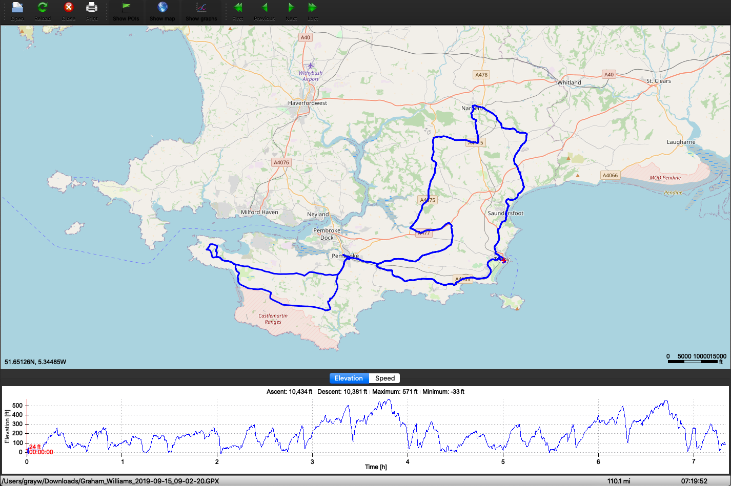
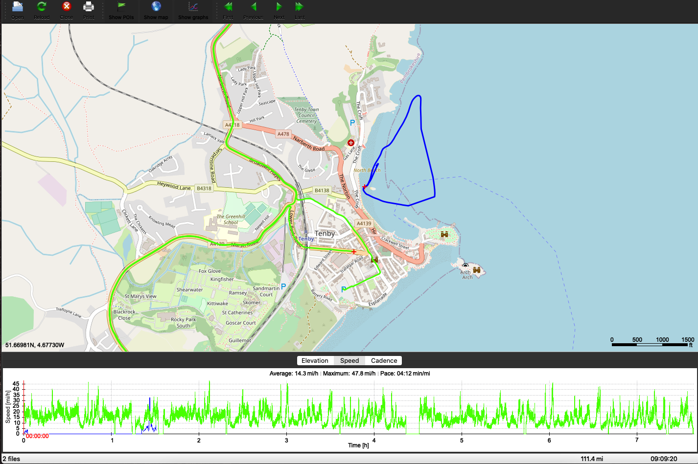
There are a selection of mapping services available too, so you're not just stuck with whatever map something like Strava or your sports watch service gives you. This allowed me to dig right in to the numbers using OpenStreetMap. Not only can it do GPX, but also TCX, and multiple at a time too! As a triathlete, this is invaluable. It means I can load up the TCX files from each segment of the race and see them together like this:
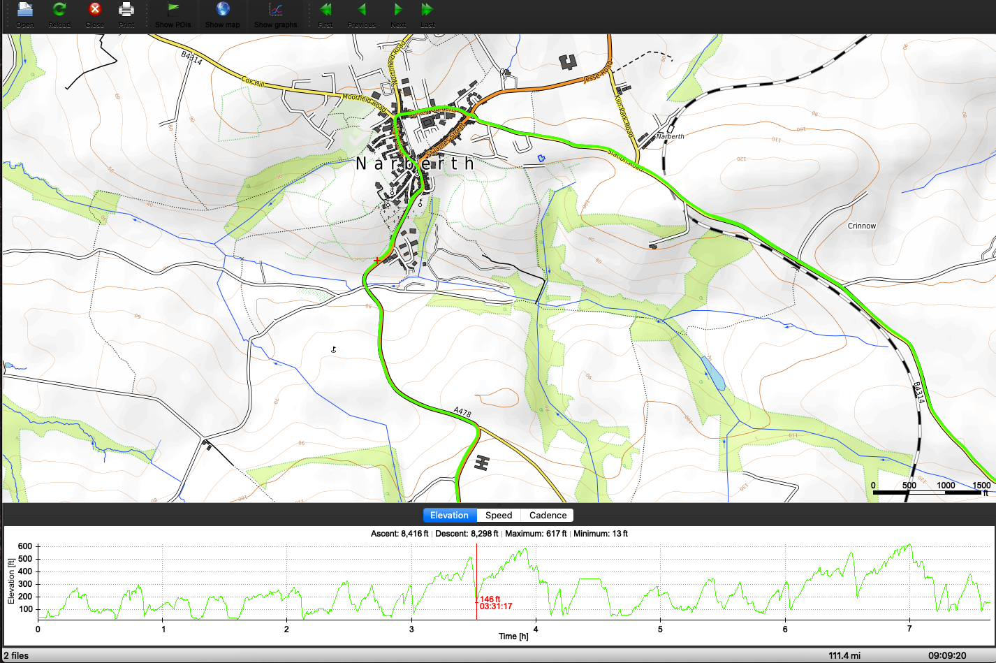
We can even get a bit nerdier and swap it out to the Open Topographical map and review one of the obnoxious climbs I faced:
It can also do so much more than I've described here and I'm really not doing it credit, so here's a list of the key features
Opens GPX, TCX, FIT, KML, NMEA, IGC, CUP, SIGMA SLF, Suunto SML, LOC, GeoJSON, OziExplorer (PLT, RTE, WPT), Garmin GPI & CSV and geotagged JPEG files.
User-definable online maps (OpenStreetMap/Google tiles, WMTS, WMS, TMS, QuadTiles).
Offline maps (OziExplorer maps, TrekBuddy maps/atlases, Garmin IMG/GMAP & JNX maps, TwoNav RMaps, GeoTIFF images, MBTiles).
Elevation, speed, heart rate, cadence, power, temperature and gear ratio/shifts graphs.
Support for DEM files (SRTM HGT).
Support for POI files.
There's so much I haven't even touched yet. If you need a piece of software to cover one of the use cases above, take a look.